Discover DIELMO 3D's new logo: sleek, dynamic, and innovative! Embracing excellence in geospatial technology within Innovation Side Holding.
Blog
Flexibility, solvency, experience, high production capacity…
DIELMO, a company specialized in LiDAR data processing, has extensive experience working in LiDAR projects with industry leaders internationally. Therefore, we are sure to provide you with the best possible technical solution to successfully carry out any type of geospatial project.
Discover DIELMO 3D's new logo: sleek, dynamic, and innovative! Embracing excellence in geospatial technology within Innovation Side Holding.
Enhance your LiDAR data capture business with reliable automation, custom algorithms, and precise, high-quality results.
DIELMO 3D has initiated a strategic reorganization aimed at optimizing management efficiency by establishing distinct companies for each of its diverse activities.
'The processing force behind your LiDAR data' was our slogan at GEO WEEK 2023. After 12 years of Dielmo 3D participating in the GEO WEEK 2023 exhibition in Denver (Colorado), we wanted to give a little humor in this edition with a nod to the Star Wars saga. The slogan: 'The processing force behind your LiDAR data'. Let me tell you how the idea came up...
One more year Dielmo 3D will participate in GEO WEEK, we are present at GEO WEEK since 2010. It will be at the Colorado Convention Center, Denver (USA)
LiDAR analysis of energy networks to detect risk areas for new fiber-optic lines in compliance with current regulations.
Recently, we have made a 1:500 mapping for the Port Authority of Cartagena and we want to show you all the ins and outs of the project. Let's go ahead and tell you about it...
Every day photogrammetric cameras are becoming cheaper, lighter, more accurate and more flexible, which is allowing companies from all over the world to start in the business of performing photogrammetric flights from drones, helicopters or airplanes. So much so that the market has gone from a few large specialized companies to thousands of new players.
In September 2022 the prestigious international journal "International Journal of Applied Earth Observation and Geoinformation" has published the scientific article "Artificial intelligence-based software (AID-FOREST) for tree detection: A new framework for fast and accurate forest inventorying using LiDAR point clouds"
Dielmo 3D is pleased to meet you at the ILMF 2022! You will find us the at ILMF 2022, booth 436, during course of the forum, from sunday 1:00 PM until Tuesday 4:30 PM.
Project in which we perform precision mapping of a study area for renewable engineering applications.
Blog LiDAR UAV mapping for Enedis distribution power network Table of contents Custom UAV LIDAR mapping solutions for ENEDIS distribution network maintenance
2cm accuracy project in Switzerland designed to create a 3 dimensional area of the existing infrastructures for further engineering projects.
In this article we analyze how forest inventory automation can be achieved using LiDAR mapping and artificial intelligence.
Development of parallelized computing algorithms to increase computational speed in BIG DATA processing on our local network.
Over 2500 miles of power lines processed in the USA from LiDAR data for power line maintenance. Safety distance analysis and customized reports, with turnaround times every 4-5 days from receipt of data for each zone.
Study, analysys and maintenance of rail network infrastructure in Australia using LiDAR data and photogrammetry.
DIELMO D S.L. has been awarded with the R&D project "Analysis of the application of Deep Learning for the resolution of geospatial problems
New project with more than 1200 km of LiDAR classification and highly detailed 3D design for transmission/high voltage network
LiDAR terrain study for 1500 km of new power grid in Africa Study, high precision terrain modeling and planning
Since 2012, Dielmo 3D has been processing and analyzing LiDAR data to report clearance distances and vegetation encroachment of over 200 000 km of distribution and transmission lines in Australia.
Discover DIELMO 3D’s new logo: sleek, dynamic, and innovative! Embracing excellence in geospatial technology within Innovation Side Holding.
Enhance your LiDAR data capture business with reliable automation, custom algorithms, and precise, high-quality results.
DIELMO 3D has initiated a strategic reorganization aimed at optimizing management efficiency by establishing distinct companies for each of its diverse activities.
‘The processing force behind your LiDAR data’ was our slogan at GEO WEEK 2023.
After 12 years of Dielmo 3D participating in the GEO WEEK 2023 exhibition in Denver (Colorado), we wanted to give a little humor in this edition with a nod to the Star Wars saga. The slogan: ‘The processing force behind your LiDAR data’. Let me tell you how the idea came up…
One more year Dielmo 3D will participate in GEO WEEK, we are present at GEO WEEK since 2010. It will be at the Colorado Convention Center, Denver (USA)
LiDAR analysis of energy networks to detect risk areas for new fiber-optic lines in compliance with current regulations.
Recently, we have made a 1:500 mapping for the Port Authority of Cartagena and we want to show you all the ins and outs of the project. Let’s go ahead and tell you about it…
Every day photogrammetric cameras are becoming cheaper, lighter, more accurate and more flexible, which is allowing companies from all over the world to start in the business of performing photogrammetric flights from drones, helicopters or airplanes. So much so that the market has gone from a few large specialized companies to thousands of new players.
In September 2022 the prestigious international journal “International Journal of Applied Earth Observation and Geoinformation” has published the scientific article “Artificial intelligence-based software (AID-FOREST) for tree detection: A new framework for fast and accurate forest inventorying using LiDAR point clouds”
Dielmo 3D is pleased to meet you at the ILMF 2022!
You will find us the at ILMF 2022, booth 436, during course of the forum, from sunday 1:00 PM until Tuesday 4:30 PM.
Project in which we perform precision mapping of a study area for renewable engineering applications.
Blog LiDAR UAV mapping for Enedis distribution power network Table of contents Custom UAV LIDAR mapping solutions for ENEDIS distribution network maintenance DIELMO3D, in collaboration
2cm accuracy project in Switzerland designed to create a 3 dimensional area of the existing infrastructures for further engineering projects.
In this article we analyze how forest inventory automation can be achieved using LiDAR mapping and artificial intelligence.
Development of parallelized computing algorithms to increase computational speed in BIG DATA processing on our local network.
Over 2500 miles of power lines processed in the USA from LiDAR data for power line maintenance. Safety distance analysis and customized reports, with turnaround times every 4-5 days from receipt of data for each zone.
Study, analysys and maintenance of rail network infrastructure in Australia using LiDAR data and photogrammetry.
DIELMO D S.L. has been awarded with the R&D project “Analysis of the application of Deep Learning for the resolution of geospatial problems
New project with more than 1200 km of LiDAR classification and highly detailed 3D design for transmission/high voltage network
LiDAR terrain study for 1500 km of new power grid in Africa Study, high precision terrain modeling and planning
Since 2012, Dielmo 3D has been processing and analyzing LiDAR data to report clearance distances and vegetation encroachment of over 200 000 km of distribution and transmission lines in Australia.
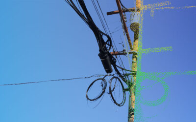
Blog Web lidar solution for telecommunications network maintenance and analysis DIELMO3D presented in Norway a web portal for the management of telecommunication infrastructures. It is
DIELMO3D performed an analysis of ENEDIS’s network for maintenance and vegetation management applications using LiDAR and UAV technologies.
The most reliable partner to process your Lidar data
For the “Development of projects related to mapping services”.