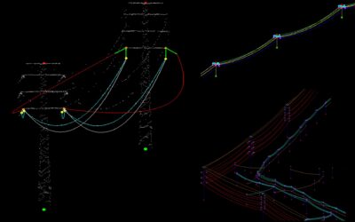
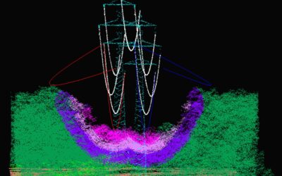
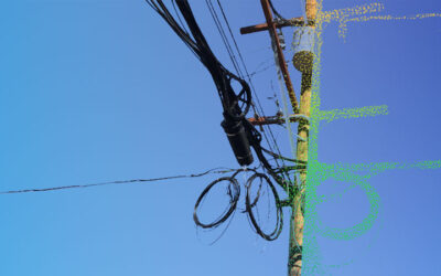
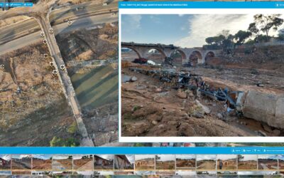
Logo Dielmo3D white
Dielmo3D logo color
  • Services
    • Lidar applications

      • Utilities
        • Vegetation management
        • 3D Utility mapping
        • LiDAR clearances
        • PLS-CADD
      Menu
      • Utilities
        • Vegetation management
        • 3D Utility mapping
        • LiDAR clearances
        • PLS-CADD

      Corridor mapping

      Flood mapping

      Forestry

      Civil engineering & renewables

      Mapping services for

      Aerial surveys

      Drone UAV

      Lidar mobile

      Public administration

      Software development

      Artificial intelligence

      Webgis geoportal

      • LiDAR software
        • LiDAR online server
        • Dielmo Open Lidar
        • Custom algorithms
        • Dielmo LiDAR
      Menu
      • LiDAR software
        • LiDAR online server
        • Dielmo Open Lidar
        • Custom algorithms
        • Dielmo LiDAR

      Custom development

  • Projects
  • About us
  • Contact
  • Services
  • Projects
  • About us
  • Contact
Menu
  • Services
  • Projects
  • About us
  • Contact
  • Español
Linkedin
Twitter
Facebook

Blog

Need help with your project?
+34 963 137 212
dielmo@dielmo.com​
Dielmo3D logo color

The most reliable partner to process your Lidar data

Certification

For the “Development of projects related to mapping services”.

Menu
  • Home
  • Services
  • Projects
  • About us
  • Contact
  • Privacy policy
  • Legal advice
  • Cookies policy
Menu
  • Home
  • Services
  • Projects
  • About us
  • Contact
  • Privacy policy
  • Legal advice
  • Cookies policy
Our offices
DIELMO 3D S.L.
Plaz​​​​​a Vicente Andrés Estellés nº2 Bajo
46950 · Xirivella, Valencia (Spain)
Tel./Fax: +34 963 137 212
dielmo@dielmo.com
Linkedin
Twitter
Facebook
Recent projects
  • LiDAR analysis of fiber and electricity networks in the U.S
  • LiDAR mapping for wind and solar farms
  • LiDAR UAV mapping for Enedis distribution power network
  • 3D road LiDAR mapping (2cm) in Switzerland
  • LiDAR mapping and Artificial Intelligence for forest inventory automation
  • LiDAR data processing supercomputing project
  • Power lines map and clearance distance analysis using LiDAR
Menu
  • LiDAR analysis of fiber and electricity networks in the U.S
  • LiDAR mapping for wind and solar farms
  • LiDAR UAV mapping for Enedis distribution power network
  • 3D road LiDAR mapping (2cm) in Switzerland
  • LiDAR mapping and Artificial Intelligence for forest inventory automation
  • LiDAR data processing supercomputing project
  • Power lines map and clearance distance analysis using LiDAR
  • LiDAR for rail network maintenance in Australia
  • R&D project award for geospatial problem solving with Artificial Intelligence
  • 3D design and LiDAR classification for high voltage network in France
  • Lidar digital terrain model for 1500 km of new electricity network in Africa
  • Maintenance of 120,000 km of power lines in Australia with LiDAR
  • Web lidar solution for telecommunications network maintenance and analysis
  • Enedis LiDAR web solution
Menu
  • LiDAR for rail network maintenance in Australia
  • R&D project award for geospatial problem solving with Artificial Intelligence
  • 3D design and LiDAR classification for high voltage network in France
  • Lidar digital terrain model for 1500 km of new electricity network in Africa
  • Maintenance of 120,000 km of power lines in Australia with LiDAR
  • Web lidar solution for telecommunications network maintenance and analysis
  • Enedis LiDAR web solution
Copyright © 2020 Dielmo 3D

We use cookies on our website to give you the most relevant experience by remembering your preferences and repeat visits.
By clicking “Accept”, you consent to our cookies policy.

Accept